SkySight LED-METAR
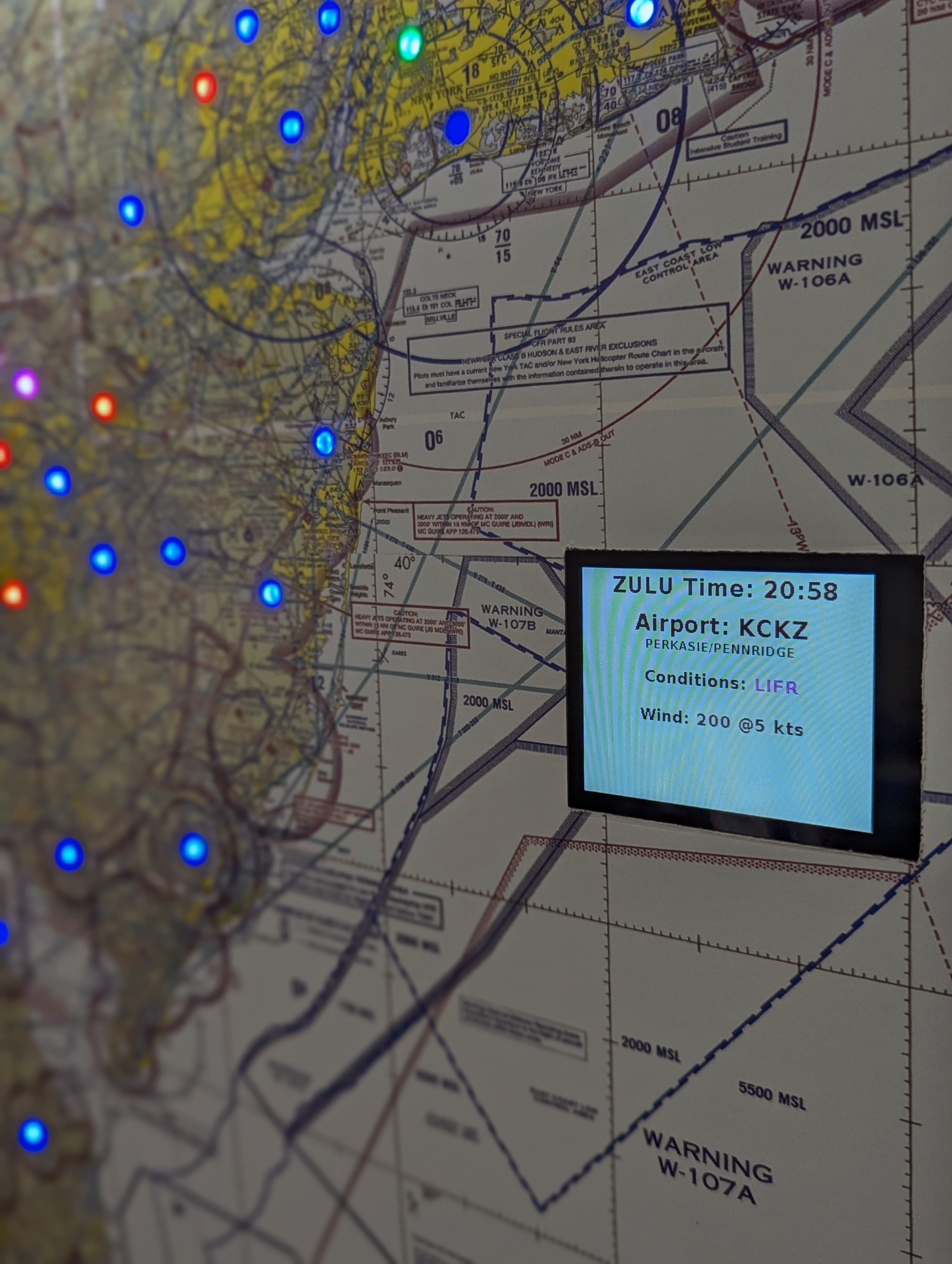
Presenting the Sky Sight LED-METAR: an LED illuminated sectional chart that shows current flight conditions for your local airports.
Presenting the Sky Sight LED-METAR: an LED illuminated sectional chart that shows current flight conditions for your local airports.
Presenting the Sky Sight LED-METAR: an LED illuminated sectional chart that shows current flight conditions for your local airports.
Unlock Real-Time Weather at a Glance with Sky Sight LED-METAR
Sky Sight LED-METAR is more than just a weather tool—it’s a statement piece, transforming raw METAR data into a captivating visual display right on your sectional chart. Using WiFi, it automatically fetches live METAR data from aviationweather.gov and displays it in an intuitive LED color system. Each airport lights up according to current flight conditions, ranging from green for VFR to magenta for LIFR.
High-Resolution Display & Precision Time Sync
Sky Sight offers the option of a high-definition color display that decodes METAR data at a glance, showing detailed wind speed, direction, gusts, and conditions. And with automatic Zulu time synchronization from Google’s NTP servers, you’re always aligned with the universal aviation timetable.
Personalize Your Sky Sight with Any FAA Sectional Chart
Choose any FAA sectional chart for your Sky Sight map, making it as personal as it is functional. Whether in a hangar, home, or office, the Sky Sight LED-METAR brings style and insight to any space.
-
Included with your purchase is the Sky Sight LED-METAR unit installed into an 18”x24” low profile frame, power supply & quick setup guide.
-
Upon powering up your new Sky Sight for the first time, it automatically generates a temporary Wi-Fi connection portal. Through this portal, you can easily select and connect to your preferred network. Your Sky Sight is designed to remember your settings, ensuring it automatically reconnects to your network every time.
Planning to relocate your device? No worries. If your Sky Sight can't find the previously saved Wi-Fi network, it will promptly open a new connection portal, allowing you to effortlessly link to a different network of your choice.
-
Currently available is our Greater NJ area map, crafted by combining the NY & Washington sectional charts.
Interested in a map tailored to your specific region? We're here to make it happen. Please note, custom requests may involve additional costs and production times can vary. Reach out to us for more details and to discuss your unique needs.
-
The map illuminates airports that report their METAR data to aviationweather.gov servers and include most major airports in the area.
Contact us to request that a specific airport be included with your order.


