


Sky Sight - LED METAR (Greater NJ Region)
This is a custom sectional composed of both New York & Washington charts, carefully stitched together to encapsulate the entire greater NJ region.
Sky Sight LED-METAR
The Sky Sight LED-METAR transforms any FAA sectional chart into a stunning aviation weather map, showcasing real-time weather conditions for selected airports with style and precision.
💡Automatic Brightness Control – A built-in light sensor adjusts LED and display brightness based on ambient lighting, ensuring perfect visibility day or night.
🌐 Web-Based Control Panel – Easily manage your Sky Sight device preferences from your browser!
✅ Adjust brightness settings
✅ Choose to cycle through all airports or display a specific one
✅ Upload device firmware updates directly
Simply connect to your device to your wifi and access everything at skysight.local/settings
Enhance your setup with optional features:
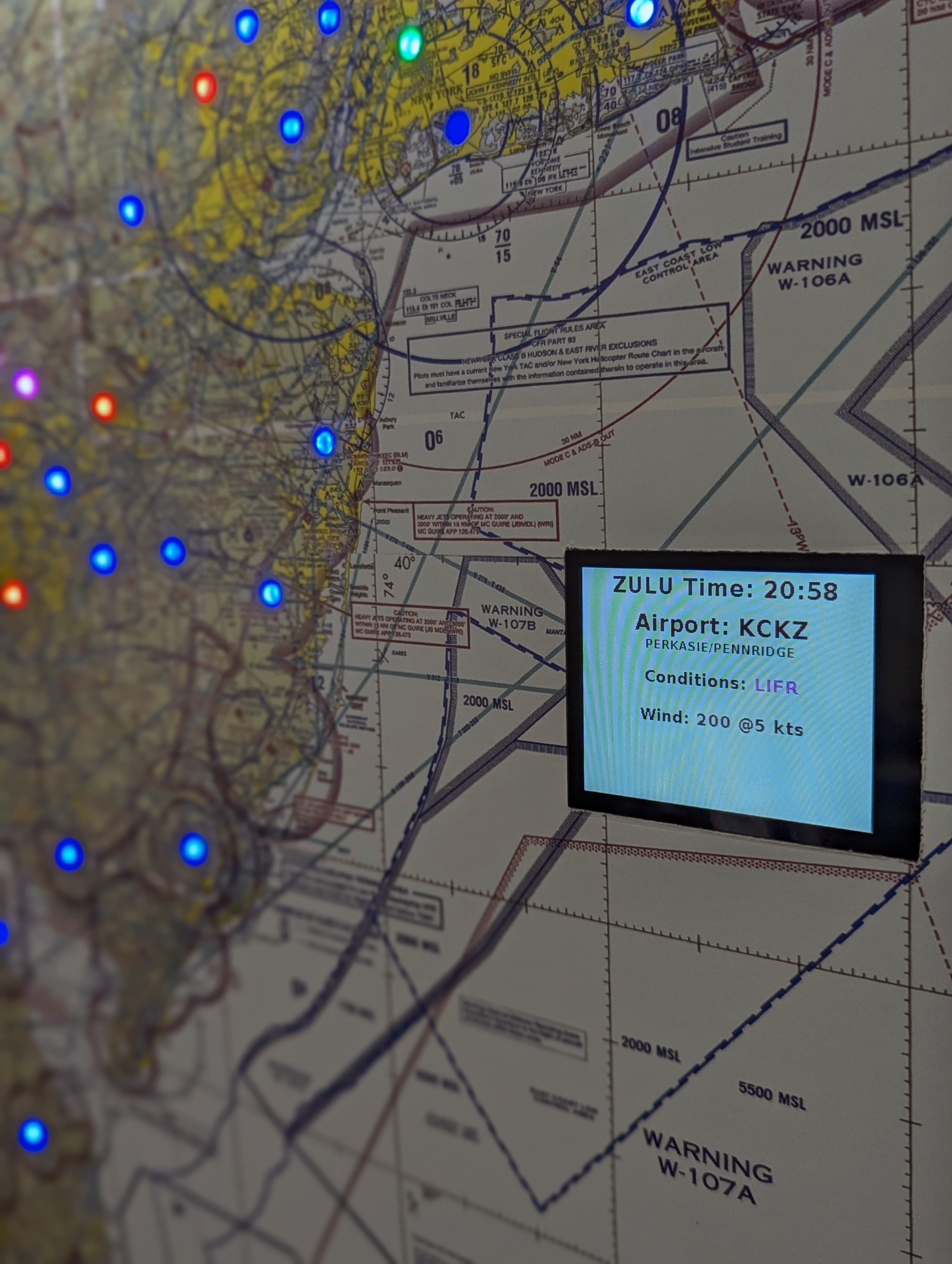
Detailed Weather LCD Display: Add an optional display to view in-depth weather information for each airport, including wind speed and direction.
In-Line Power Switch: Upgrade your device with a convenient in-line power switch, allowing you to easily turn it on or off without unplugging the power cord. Simply toggle the switch for hassle-free control.
Perfect for pilots, aviation enthusiasts, and weather watchers, the Sky Sight LED-METAR brings real-time weather updates to life in a visually captivating and functional way.

-
Wi-Fi Connectivity: After setup, it connects to your Wi-Fi to get the latest weather data from trusted sources.
Real-Time METAR Updates: Sky Sight regularly fetches data to ensure you have the most current info, including flight categories (VFR, MVFR, IFR, LIFR), wind direction, and gusts.
Automatic Brightness Adjustment: A built-in ambient light sensor dynamically adjusts LED and display brightness based on surrounding light conditions, ensuring optimal visibility day or night.
Intuitive LCD Screen: An optional display shows detailed weather information for each airport, including wind speeds and directions in real-time.
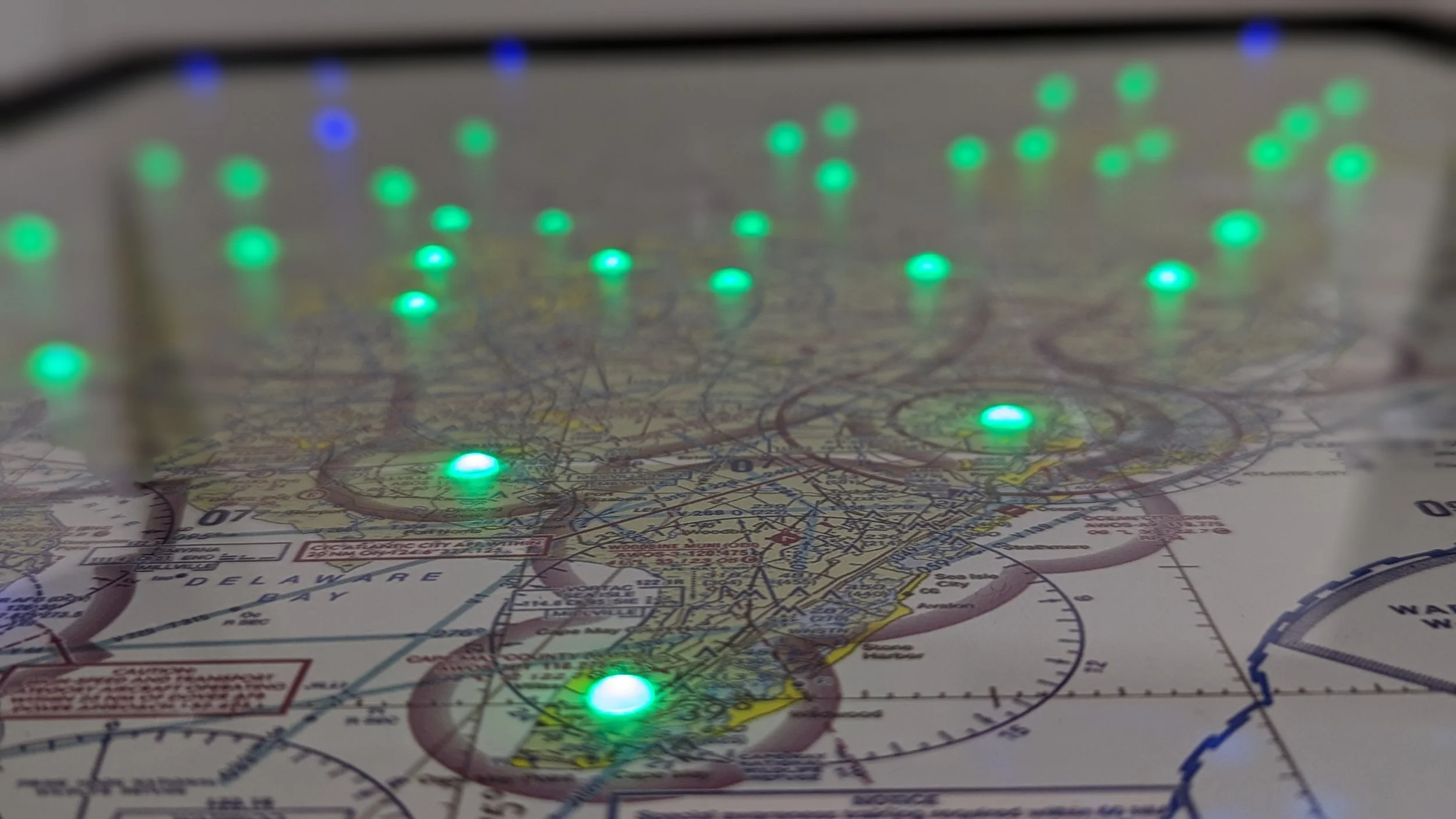
Dynamic LED Display: Each LED represents an airport and changes color based on flight conditions:
🟢 Green: VFR (Visual Flight Rules)
🔵 Blue: MVFR (Marginal Visual Flight Rules)
🔴 Red: IFR (Instrument Flight Rules)
🟣 Magenta: LIFR (Low Instrument Flight Rules)
-
Your purchase includes the Sky Sight LED-METAR unit mounted in an 18”x24” low-profile frame, a built-in ambient light sensor for automatic brightness adjustment and power supply.
-
The map illuminates airports that actively send their METAR data to aviationweather.gov, ensuring comprehensive coverage of most major airports located in the surrounding area.